| Estimated Maximum Intensity: |
I
|
| Date: |
November 28, 2012 00:20:46 UTC
November 27, 2012 20:20:46 Local Time |
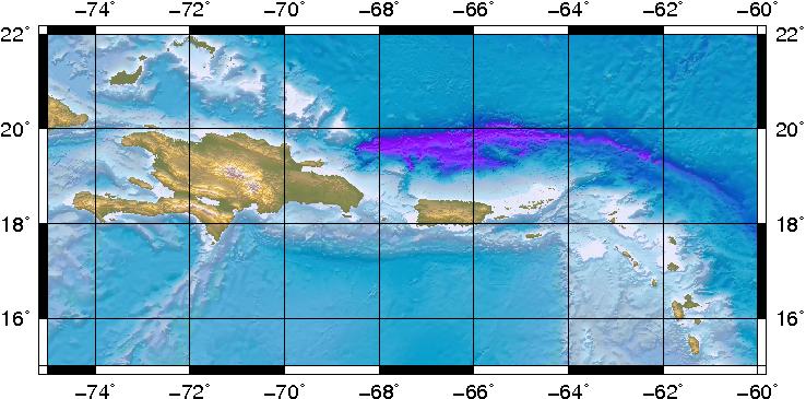
| Region: |
Septentrional Fault Zone |
| Distances: |
56.06 Km East of Samaná,DR
66.33 Km North-Northwest of Punta Cana,DR
226.24 Km West-Northwest of Mayagüez,PR
|
| Magnitude: |
3.96 Md |
| Location: |
Latitude:19.3091 Longitude:-68.8393 |
| Depth: |
139 Km |
| Tsunami Warning Level: |
No Warning, Advisory or Watch is in effect for Puerto Rico and the Virgin Islands
|
| Issued date and time : |
2012-11-27 20:54:39 |
| ID: |
20121128002049 |
|