| |
| Earthquake Details |
| |
| Estimated Maximum Intensity: |
I
|
| Date: |
March 11, 2014 02:44:06 UTC
March 10, 2014 22:44:06 Local Time |
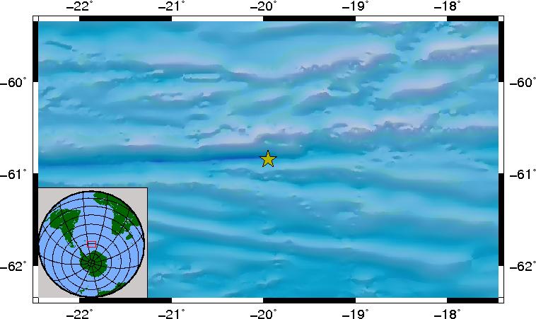
| Region: |
EAST OF SOUTH SANDWICH ISLANDS |
| Distances: |
4942.09 Km East of Coral Bay, St. John,USVI
9717.63 Km Southeast of Montserrat,UK
10084.82 Km Southeast of San Juan,PR
|
| Magnitude: |
6.8 Mwp |
| Location: |
Latitude:-60.847 Longitude:-19.951 |
| Depth: |
16 Km |
| Tsunami Warning Level: |
No Warning, Advisory or Watch is in effect for Puerto Rico and the Virgin Islands
|
| Issued date and time : |
2014-03-10 23:06:27 |
| ID: |
20140311024407 |
|
|
|
| |
| |
|


