|


|
|
|
|
| This information is issued for Puerto Rico and Virgin Islands. For additional information visit the website of your Corresponding Seismological Institution or the Tsunami Warning Centers |
|
| |
|
| |
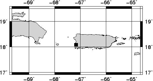
Epicentral Map(PRSN), Last Modification: 2012-07-06 14:06:09 Local Time.
| BULLETIN 1 |
| SEISMIC EVENT/TSUNAMI |
| |
| DATE: |
July 06, 2012 |
| LOCAL TIME: | 02:48:40 |
| LATITUDE: | 18.0805 N |
| LONGITUDE: | 67.1686 W |
| LOCATION: | 3.4 Km Northwest of Cabo Rojo,PR
15.7 Km South-Southeast of Mayagüez,PR
|
| DEPTH: | 11 Km |
| MAGNITUDE: | 2.88 Md |
| ESTIMATED MAXIMUM INTENSITY: |
III in Cabo Rojo, PR |
|
| TSUNAMI WARNING LEVEL: |
No tsunami threat for Puerto Rico and the Virgin Islands
|
| ISSUED DATE AND TIME: |
2012-07-06 10:06:09 |
|
The Puerto Rico Seismic Network (PRSN) received information that this micro earthquake was reported as felt in Cabo Rojo and Maricao with a maximum intensity of III (Modified Mercalli Scale, MM). At the moment of generating this bulletin no damage has been reported and is not expected to occur.
. |
|
|
|
|
| |
| |
|
| Print Version |

|