|


|
|
|
|
| This information is issued for Puerto Rico and Virgin Islands. For additional information visit the website of your Corresponding Seismological Institution or the Tsunami Warning Centers |
|
| |
|
| |
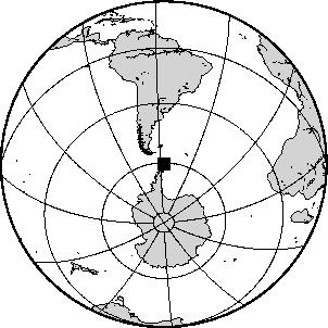
Epicentral Map(PRSN), Last Modification: 2012-01-15 16:42:37 Local Time.
| BULLETIN 0 |
| SEISMIC EVENT/TSUNAMI |
| |
| DATE: |
January 15, 2012 |
| LOCAL TIME: | 09:40:18 |
| LATITUDE: | 60.765 S |
| LONGITUDE: | 55.858 W |
| LOCATION: | 1066.4 Km East-Northeast of Coral Bay, St. John,USVI
8752.8 Km South-Southeast of Ponce,PR
|
| DEPTH: | 10 Km |
| MAGNITUDE: | 6.6 Mw |
| ESTIMATED MAXIMUM INTENSITY: |
I |
|
| TSUNAMI WARNING LEVEL: |
No tsunami threat for Puerto Rico and the Virgin Islands
|
| ISSUED DATE AND TIME: |
2012-01-15 12:42:23 |
|
|
. |
|
|
|
|
| |
| |
|
| Print Version |

|