| |
| Earthquake Details |
| |
| Estimated Maximum Intensity: |
I
|
| Date: |
January 15, 2012 13:40:18 UTC
January 15, 2012 09:40:18 Local Time |
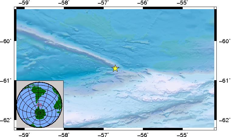
| Region: |
SOUTH SHETLAND ISLANDS |
| Distances: |
1066.4 Km East-Northeast of Coral Bay, St. John,USVI
8552.6 Km South of Montserrat,UK
8752.81 Km South-Southeast of Ponce,PR
|
| Magnitude: |
6.6 Mw |
| Location: |
Latitude:-60.765 Longitude:-55.858 |
| Depth: |
10 Km |
| Tsunami Warning Level: |
No tsunami threat for Puerto Rico and the Virgin Islands
|
| Issued date and time : |
2012-01-15 12:42:23 |
| ID: |
20120115134021 |
|
|
|
| |
| |
|


