| |
| Earthquake Details |
| |
| Estimated Maximum Intensity: |
I
|
| Date: |
February 18, 2014 09:27:12 UTC
February 18, 2014 05:27:12 Local Time |
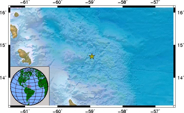
| Region: |
NORTH ATLANTIC OCEAN |
| Distances: |
426.39 Km East-Southeast of Montserrat,UK
490.62 Km Southeast of Nevis
884.25 Km East-Southeast of San Juan,PR
|
| Magnitude: |
6.5 Mwp |
| Location: |
Latitude:14.651 Longitude:-58.948 |
| Depth: |
16.9 Km |
| Tsunami Warning Level: |
No Warning, Advisory or Watch is in effect for Puerto Rico and the Virgin Islands
|
| Issued date and time : |
2014-02-18 08:29:05 |
| ID: |
20140218092709 |
|
|
|
| |
| |
|


